July 2006: Surf Trip to the Galapagos Islands
Page 3 - Baltra & Santa Cruz, Waves at Chicken Hill
Holy hot fucking damn, I’m actually on the ground in the Galapagos Islands!
THE FUCKING GALAPAGOS!!!!!
I can’t really call this a dream of a lifetime, ‘cause I never really dared to dream that I should ever be so lucky as to set foot on this rocky land.
And yet, here I am.
How am I going to write this?
I do not know.
I guess I’ll just stutter and stumble through it as best I can, leaving out great gouts of important information that a sensible reader might expect to see, and just hope for the best, with whatever it is that might run off the ends of my fingers here as I give the keyboard on this old laptop a good workout.
Ok. Last I wrote, we were over the Pacific, well away from Ecuador, with the solid overcast at the coast breaking up into scattered patches of stratocumulus.
Things remained monotonously the same until we were well into our descent, at which point the clouds gathered themselves back up.
Out of the left side of the airplane, all of a sudden people are pointing and exclaiming, and then quite a few others from the right side, where I was seated next to a window, all get up and peer through the windows.
Must be San Cristobal.
I stayed put and figured I’d be seeing plenty, soon enough, so why rush things?
Just so you know, we’re landing on Baltra Island.
Baltra is a small, flat island, that almost, but not quite, touches the much larger island of Santa Cruz. It’s just north of Santa Cruz and is where the U.S. Navy built a base back in World War II, to help protect the Panama Canal, of all weird things.
The U.S. is long gone from Baltra, but the Ecuadorian Navy now has a station here and the runway is still operational and serves as one of the main embarkation points for the Galapagos archipelago.
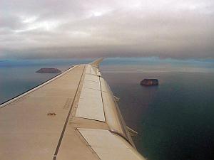
Baltra/Santa Cruz is located nearly in the center of the Galapagos archipelago, with islands off in the distance at all points of the compass.
 |
 |
 |
||
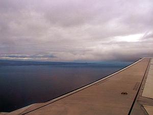
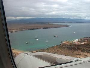
| Daphne Major and Daphne Minor | Santa Cruz shield volcano flank | Flat Baltra with high Santa Cruz in the distance |
So we fly into Baltra from the east and take a nice easy left hand turn and now islands are showing up off the wing, ahead and behind, now that we’ve descended below the layer of stratocumulus. Looking as far forward as I can, I can now see the far flank of the shield volcano that is Santa Cruz. Quickly, the flat aspect of Baltra itself appears, with a few boats bobbing in a small notch on it’s west side. And then we’re over land. It rushes by underneath us, gray green and sere.
We’re on the dry side of Santa Cruz here and it’s near desert down there.
Cactus. Lotta large cactus trees. Kind of like prickly pears, but much taller. In between the cactus, a grey scrub of very anonymous looking foliage, with the background sand and lava showing in through here and there.
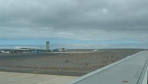 |
| Baltra airport |
Touchdown.
Holy golamighty, I’m actually in contact with the ground, in THE FUCKING GALAPAGOS!!!!!
The airport is a scroungy-looking little thing, with a few small planes parked around and very little by way of what you might expect by way of proper airport infrastructure.
Immediately, you can see that they are trying to keep things low key here, disturbing the background ecosystem as little as possible. I like the look and feel of this tiny airport VASTLY more than I do your typical steel and concrete monstrosity that serves passenger aircraft.
You can tell that this place, at one time, was worked over pretty good by the military. Back in World War II, with the threat of a Japanese invasion a very real thing in people’s minds, the little niceties of preserving some lizard’s front yard had to be suspended.
It was a different time, and those were different people, and I begrudge them none of what they did here on the island of Baltra.
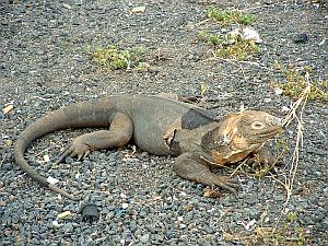 |
| Airport Lizard |
Walking from the tarmac to the reception building, a large iguana is laying right next to the sidewalk, completely oblivious of the hundreds of people swarming all around it at arm’s length, disembarking from the A320.
Cool.
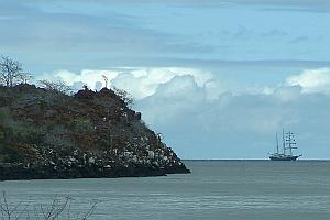 |
| Three-masted ship around the corner at Baltra |
Looking around, it’s some rough country out there. Little sign of water anywhere. Gray scrub and cactus, with sand and rocks, and that’s it.
Couldn’t have been much fun to show up here in the days of three-masted ships, low on food and water.
We go through immigration and inspection of our belongings, and we’re now on the ground in what is perhaps the finest national park in the world.
THE FUCKING GALAPAGOS!!!!!
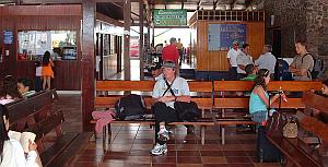 |
| On the ground in the Galapagos |
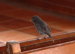 |
| Darwin's Finch inside the airport |
A Darwin's Finch, just as nondescript as you could possibly imagine, flits to a landing upon one of the benches inside the airport, right next to me, and proceeds to ignore both me, and the churning throng of everybody else in here, with utmost aplomb. The thunderstorm of insight that these little creatures ignited beggars the imagination and continues to rumble and rattle down through the corridors of time, greatly disturbing small-minded sorts who cannot successfully wrap their limited mental powers around the fullness of what it all really means.
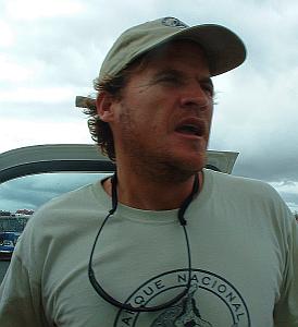 |
| Andres |
In short order, we are met by Andres, who will be our guide for this trip.
He’s a big ruddy Ecuadorian, despite his somewhat gringoish look.
He speaks excellent English, and wastes no time in organizing and making ready for our departure.
We’re headed to Puerto Ayora, which is almost precisely on the opposite side of Santa Cruz from where we are now located.
Which means we’ll get to drive directly across Santa Cruz, getting a good look at the island, from it’s low lying edges, right on up to its highest point.
Down here at sea level, the air is just about perfect in temperature. Not hot, not cold. There is a deck of low stratocumulus blocking the sun, and the overcast, coupled with the sparse and harsh vegetation, gives the place a very serious look.
We’re in some no fooling around territory here, people. This place cares not a whit for me, my possessions, or anything I might think of it. It just IS.
Splendid. Fucking SPLENDID.
We are ushered into the back of a flat bed truck, with chest high railings along the sides.
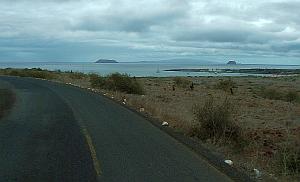 |
| Daphne Major & Minor with Santiago in the distance |
The people handling the baggage are somewhat flummoxed by my enormous board bag, apparently having never dealt with such a ridiculous thing before.
No problem, soon we are packed into the back of the truck, along with several other passengers, including some military types, hitching a ride along with their dogs.
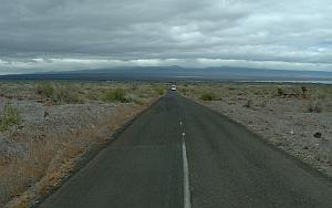 |
| Across Baltra with Santa Cruz looming in the distance |
Everyone is smiling as we lurch out on our short journey to the south side of Baltra, where we will take a very short ferry ride across to Santa Cruz itself.
Along the way, remnants of the former military base that once occupied this land are evident, scattered around randomly here and there.
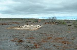 |
| World War II military relics |
Bleached foundation slabs and mysterious low concrete boxes and structures are sprinkled among the scrub.
Ah, if only they could talk. The stories they could tell!
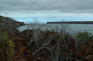
And then we round a final bend and there is the channel before us.
 |
| Baltra/Santa Cruz channel |
It’s not as I imagined it would be.
To look at the map, you might think that it’s just a shallow area where the land slopes just a bit too low, with salt water washing across a sand flat, shallow rocks, or something similar.
Nope.
The edges of both Baltra and Santa Cruz drop off abruptly, basaltic in every aspect, and the water seems fairly deep. There’s a goodly current running through the channel, from west to east right now.
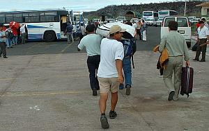
Off the truck, grab the gear, toss it on to the small ferry, and across we go.
 |
| Three(!) guys to handle my boardbag |
Landing on the Santa Cruz side, we work things in reverse, and we’re being helped toward a white pickup. THREE people work my bag from the ferry, and then proceed to stay with the bag, carrying it like pallbearers taking a coffin to a gravesite. Jason is quite amused at the sight of this.
Into the truck, boards are in the back, and we’re off.
Santa Cruz is a proper shield volcano, and none too old. Has a quite Hawaiian look to it, or at least it looks like some of fresher parts of the Big Island does. But it’s not nearly as large as the big Hawaiian shield volcanoes such as Haleakala, Mauna Loa, and Mauna Kea, are. Kind of a miniature Big Island. It’s only about twenty five miles across, and since shield volcanoes all have very gentle slopes, it doesn’t get all that high at its center, the way the Hawaiian Monsters do. That said, the highest point on the island is a little over three thousand feet in elevation, plenty high enough to penetrate the base of the marine stratocumulus, and today the top of the island is completely hidden within a cloud.
We’re headed directly up into that cloud.
Along the way, Andres is giving us instructions on how to behave on these islands. Respect for the land, the plants, and the animals is paramount, and Andres is loud and clear on these points. His feelings for his home are strong, and you can tell that he has a deep care about and for this place. I’ve decided I like Andres a lot. He’s no lightweight. We are lucky to be in his hands.
Outside, the scrub has turned into a bizarre forest of smallish bushy trees, none of which appear to have any leaves. Weird looking. How do these things survive. They are not dead, but neither are they particularly alive.
Away from the coast, but before we actually get into the cloud, the air suddenly turns much cooler. Not cold, but certainly cool. Quite nice, actually.
And we wind ever upwards and as we approach the top of the island, the vegetation begins to change over to a peculiar version of a cloud forest, on young lava.
Again, the parallels with the Big Island are quite evident. We’re now driving through what passingly resembles an ohia forest, except that these trees are NOT ohia. It’s an indigenous species found only on the Galapagos, and it’s called scalesia. Very interesting stuff.
Well into the cloud now, and everything is dripping wet, and there’s an extremely thin rain floating in the air, not much heaver than a fog.
We stop at a small place on the side of the road, and Andreas beckons us toward a path into the scalesia. We walk through it, among the dripping trees and ferns, through the cool air across young lava with just a bit of volcanic soil that has formed upon it, and then all of a sudden we are presented with a gigantic pit in the earth.
 |
Again, the parallels with the Big Island are uncanny. There are pits exactly like this one on Kilauea’s southeast rift zone.
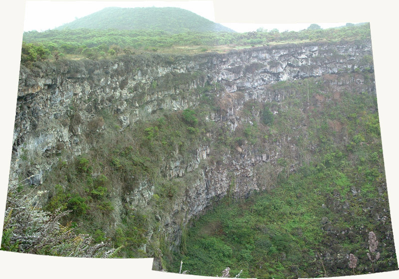 |
Somewhere, down beneath us, something has given way and this vertical-walled pit, perhaps a couple of hundred yards across, and nearly as deep, has formed. At the bottom, is a scree of lava blocks covered with vegetation. The walls of the pit are perfectly vertical, and display the layers of basalt that congealed from the successive lava outpourings that formed this island. As in Lanikai, on Oahu, each flow of basalt is quite thick, perhaps ten or fifteen feet deep. From this I surmise that we are somewhere near the original caldera at the summit of this island. Perhaps I’m right, perhaps I’m wrong. Who can know? Who can care?
It’s beautiful.
After a short time studying this natural wonder of the earth, Andres says we must now go. It is getting on into the afternoon, and if we wish to catch waves today, we must get a move on.
Ok, fine.
And so we head back toward the truck, the driver still with it, but Andre does not stop at the vehicle but instead crosses the pavement of the road (this road is a good one, well maintained) and disappears into the faux ohia forest once again.
Ok, fine.
And then, after an equally short walk as before, we are presented with ANOTHER pit, a twin of the first.
Amazing.
I snap away with the camera in the limited time that I have, wondering about the geology that caused this pair of features to appear in the surface of this island, side by side, and then it really is time to go and we go.
And we are now headed down, along the southern, windward side of the island.
The difference from the dry side could not be more complete.
Lush vegetation everywhere.
Trees, grass, bamboo, the whole works. At least up high. Down lower, things dry out once again.
Really cool.
And, as the road winds on, we start to encounter signs of human habitation.
We pass by houses, buildings, side roads, and people here and there.
Civilization.
It’s a bit of a town, and once again, it looks like the Big Island. Similar look to the roads, houses, and all the rest of it.
I feel strangely at home, and even the smell of the island is Hawaiian.
And please, anyone on the Galapagos who might chance upon these words, I mean no disrespect by repeatedly saying that your marvelous islands are similar to some other place. The Galapagos Archipelago is unique on this small blue planet, and I’m only attempting to relate the sights, sounds, and smells I was so miraculously fortunate to experience, to something that may contain a bit of familiarity for other people who have not been so lucky as to have visited your home.
On down we go, and intermittently, between the clouds that hover around us, we can see the blue ocean and whitewater at its edge.
Waves?
Perhaps.
The swell models for Ecuador (which is as close as I could get to the Galapagos) were calling for four and a half to five feet of south southwest swell, at about fourteen to sixteen seconds.
Might be waves, boys and girls.
 |
| Puerto Ayora |
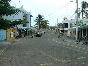
Now we have arrived at Puerto Ayora.
It’s a proper town, and much bigger than I expected.
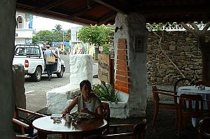 |
| Puerto Ayora |
Please note that it is in no way a big town. I was expecting NO town.
And it’s funky, friendly, and just a generally easygoing kind of place. The locals all appear to be happy and healthy and the beggars I encountered on the mainland have thankfully disappeared altogether. Everyone is doing well, and it shows. In addition, the taciturnity of the mainland has also lifted. Smiles and hello’s come much easier from friends and strangers alike. There is just a generalized pleasantness about the place that simply did not exist back in Quito.
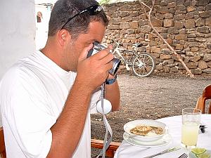 |
| Travel Professional, dedicated to full documentaion |
We take a quick stop in a local eatery for some yummy food, and refuel ourselves prior to any further exertions.
Ecuadorians mingle with an equal number, or perhaps a majority, of gringos of all shapes and sizes.
This place is a destination.
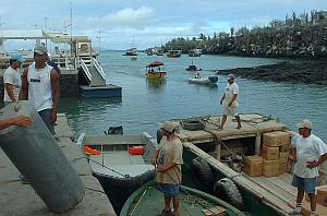 |
| Puerto Ayora harbor with Santa Fe in the far distance |
For people who travel here from all across the world.
And Puerto Ayora is a major arrival and departure point for the wide array of activities that can be partaken of in the Galapagos.
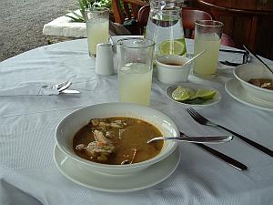 |
| Travel Professional's-eye view of things |
At the port, the southern edge of Santa Cruz is interrupted by a notch that extends maybe a mile toward the center of the island, trending generally southeast to northwest.
The endless swells from the southern ocean are dampened and die out by the time they reach the inner portion of this largish notch in the coastline.
Black basalt lines the water on all sides, and on the southwestern side, there is a lava wall, ten meters high, that runs the length of the inner harbor.
Boats are everywhere.
This is a BUSY place.
The harbor is lined with shops, hotels, watering holes, and business of all kinds.
Roads wind away from the main drag, and I only wish I had the time to properly walk down them, one and all, the better to absorb the ambience of this completely unique place.
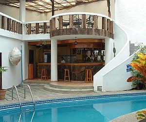 |
| Our hotel, the Lobo de Mar |
We are taken by Andres to our hotel, the Lobo de Mar, where we are checked in, and given a room number, but we don’t even bother to go up into the room. We’re traveling light, and have no sensible luggage aside from our board bags, and we’re off to the quay, where a water taxi will take us to our boat, the Maverick. The hotel looks very nice, but we have no time to check it out, right now.
At the water’s edge, people are coming and going in endless streams. Hippy looking euro-backpackers cheek-by-jowl with overdressed middle-aged white-bread Americans, and all points in between. Humanity in all its multifarious incarnations, on an isolated volcanic rock out in the middle of the ocean.
Fascinating.
Darwin’s finches flit around, paying no notice whatsoever to the humans.
The damn birds around here just don’t give a shit.
You’d never see that back in Florida, that’s for sure.
The harbor is very rough around the edges, and anything larger than a panga must ride at anchor, well away from the harsh rocky perimeter of this place.
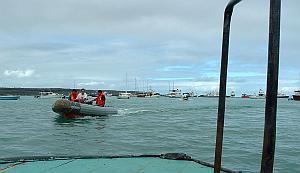 |
| On the water taxi, in the middle of the harbor |
And so you hail a water taxi, and go to your boat in this manner. The taxis are small open boats with outboards on back. There are lots of them. As you putter across the water, blue footed boobies come screaming down out of the sky like crazed dive bombers, entering the water at high speed alarmingly close at times.
Avoiding perdition at the hands of a kamikaze bird, threading our way amongst a welter of other taxis and a surprisingly large number of bigger boats, we arrive at our destination. Andres and Christian (who runs Galapagos Surf Tours and is as nice as they come) ably assist us in getting into our boat.
The Maverick is a thirty-six foot Sea Ray, and looks ready to rumble.
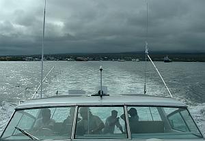 |
| Headed to sea, aboard the Maverick |
We drag the stuff onto the boat and in short order we’re under way. A couple of crew members who’s names I did not get, myself, Jason, Christian, Andres, and another Andres round out our crew. The ‘other’ Andres is a young Ecuadorian and Christian tells me he’s the head of the local Galapagos surfing association. He’s smaller than our other Andres, and so he gets christened ‘Andresito.’
He’s a hell of a nice guy, as are all the others, and we hit it off well from the beginning.
I can see all of these guys looking at my aged self, along with my strangely long surfboards, and wondering just exactly what the hell they’ve managed to get hold of here.
But first, a note about boats and myself at this point may be in order.
My experience and background with boats is essentially nil.
I’m not fond of the things at all, and have never been to a place where a boat is required to access the surf, or anything else for that matter. For me, boats are exactly like cars. A large, loud, smelly contraption with cramped interior space, that one must get inside of and then endure for the time it takes to get from a certain ‘here’ to ‘there.’ Nothing more. No sex appeal. No attraction. No interest, for that matter. I have never, over the entire course of my life, understood why people get all hot and bothered over boats and cars. Boats and cars are stupid, fer chrissakes. They perform a useful function, now and then, but that's it. Nothing more.
And so I find myself wondering if I’m going to be getting seasick as we enter the open ocean south of Santa Cruz, which is where we seem to be heading right now. Ain't never done this before. Can't know what might happen.
We’ll soon see, I suppose.
And once again, perhaps I should back up a little at this point, the better to illustrate some of the questions in my mind.
To begin with, I’ve studied the climate and weather of the Galapagos a little bit prior to departure, and am aware that the wind almost always blows from the south around here.
Ok, fine.
Trouble is, during July, the swell is also from the south.
Which would seem mean that we are going to be riding junky chop, instead of clean walls.
Phoo.
My first words concerning the waves spoken to Andres concern the cleanliness of the waves. I advise that we will cheerfully give away a little size in exchange for clean conditions. He advises me that he will take me to the ‘best’ wave and that, more or less, is that.
Earlier, Jason and I had settled on a plan of action that would have us sampling as many different waves as possible, in short sessions comprising four or five rides, and then moving on to the next spot. This seemed the most sensible way to take the best advantage of our dreadfully short allotment of time here, to allow us to be able to describe these waves to prospective clients at Surf Express. Which of course, is the whole reason for coming here in the first place, yes?
Yes.
Additionally, we had also planned on making the four hour crossing over to the neighboring island of San Cristobol, in order to get a feel for it as well.
And, on top of everything else, we had major concerns of being able to take proper photographs of waves with offshore winds that might illustrate to our clients what sort of wave they might expect to ride when they arrived here.
So there’s a lot of stuff going here, ok?
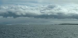 |
| Well at least something's breaking out there |
Ok.
Back to the Maverick.
We’re chugging along at about ten knots, and it’s already getting along into the afternoon.
Time is pressing down on us like a trash compactor, and the wave we’re being taken to, is way the hell over on the southwest side of the island, over an hour away.
Just one wave.
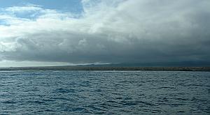 |
| Crinkly water, south of Santa Cruz |
We ask about the conditions and are told it will be good, but I’m having trouble equating that with this wind that’s coming up from the south, although not all that strongly.
There’s no whitecaps, but there’s a healthy crinkle to the surface of the water.
Hmm hmm hmm.
Oh well, I’m in it now, for whatever it might turn out to be, so I may as well relax.
Along the way I can clearly see waves breaking here and there, but from the back it’s very difficult to tell exactly what they’re doing.
Andres and Christian continue to inform us that the wave they are taking us to is ‘the best’ but I just can’t shake the doubts about this whole enterprise that have been plaguing me from the beginning.
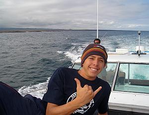 |
| Andresito insists we're doing the right thing |
Andresito also smilingly insists that we are doing the right thing, so who am I to argue with any of them?
Nobody, that’s who.
On and on the boat drones, the smell of diesel lingering within, at about ten knots of speed.
Which brings up something else about boats I don’t much really care for: As a mode of transportation, the damn things are SLOW.
But we’re getting there anyway, beneath the low overcast with Santa Cruz looming to our north across the crinkled gray water.
The sun is now moving inexorably downward, toward the horizon, and we haven’t even arrived at our first wave yet. How the hell are we going to check out multiple surf spots at this rate? And if we toss in the crossing to San Cristobol, then none of this can work, can it? And the fucking wind’s onshore, too. This isn’t looking good at all. Oh well, it’s out of my hands and there’s not a damn thing I can do about any of it. May as well preserve my good mood and let things sort themselves out on their own.
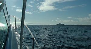 |
| Chicken Hill in the distance |
There is a landform that we have been looking for and finally it reveals itself in the distance.
More droning and diesel fumes, and finally, FINALLY, we have arrived at Chicken Hill.
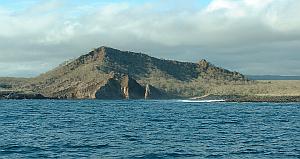 |
| Chicken Hill |
We have arrived at another notch in the coastline (and not the only one that we’ve seen along the way getting here, by far), but it’s a MUCH smaller one than Puerto Ayora. Just a little vest pocket of a thing, with a very distinct geological feature at its head. A small secondary volcanic cone is sitting in there, partially eaten away by the sea.
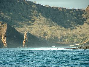 |
| Looking downpoint at Chicken Hill |
The Maverick is worked down into the tiny bay and the anchor is dropped.
And miracle of miracles, I realize that I’m not seasick in the slightest. Nary a twinge of it. Hooray!
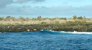 |
| Lefts were winding down the point |
Across from us, lefts are winding along the eastern side of the notch, not so very far away from the lava rocks. No sand anywhere. Just black basalt.
From our distance, it’s hard to get a decent read of the wave, and the complete and utter isolation of the place, with NOTHING except basalt and cactus to serve as a comparison, doesn’t do anything to help matters.
We are completely alone, miles and miles from anybody or anything.
No roads on the island come anywhere near this place, and no other boats are within ten miles of us from the looks of things.
It’s just us and this still unknowable left-hand wave.
Well and good, may as well get into the water and see for ourselves what’s going on.
I’m waxing my board, sitting on the back of the Maverick, and I can’t help but notice that we’re at a pretty damn good setup, with point waves winding down the rocky shore, and some occasional fair decently sized sets coming through.
For some reason, the crinkle doesn’t seem quite as bad in here, and despite the fact that there’s no spray blowing over the backs of these waves, I’m getting the idea that it might be an ok ride anyway.
I’ve brought two longboards with me. My primary board, which was shaped by Claude Codgen, and my backup board which I shaped myself as a result of the kindness of Bob Strickland, in his shaping room, using his templates and tools, prior to his passing away at far too young of an age.
Tie the leash to my calf, and splash we go, into the water, and paddle over to the point.
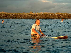 |
| Jason, Myself & Andres in the water at Chicken Hill |
Alone.
Just the four of us.
Andres, Andresito, Jason and myself.
Gotta like that.
Me, being me, I grab the first thing that comes my way and just get up and go for it.
Keep in mind that I’ve never set eyes on this place in my life and know exactly nothing about it.
So of course, me still being me, I turn around backwards and ride the wave without looking where I’m going.
It’s a so-so kind of wave, maybe about head high on the takeoff, and I’m just riding and riding, on and on, without even looking over my shoulder, taking it to the bitter end.
It’s low tide, by the way.
Suddenly, I feel a violent bang as the fin hits something substantial, and I’m thrown into the water.
What the fuck, over?
I come up to find my board floating right side up, and exposed lava sticking up out of the water around me.
Uh oh.
I hop on to the board, and begin to paddle back up point, but the board has that funny, squirrelly paddling motion that can only mean one thing.
I hop off, turn the board over, and sure enough, not only is the fin broken completely out of the box and gone forever, the box itself is partially ripped out of the tail of the board.
ON MY FIRST FUCKING WAVE!!!!!
Well dammit MacLaren, you’re just about a DUMB motherfucker, aren’t you?
Yes, your Honor. Yes I am. Guilty as charged.
Oh well, no sense in getting into some kind of mood over this and ruining the session, may as well paddle back to the boat and get the backup board.
Which I do.
Put the spare fin into the spare board, shrug my shoulders, and over the side I go, once again.
Paddle back up to the head of the point, and while all this is going on, a fairly sizeable set comes through.
Hmm.
So instead of sitting over where Andres and Andresito are located, I just kind of go with my own instincts and move outside and away from the point and wait things out.
Eventually, an overhead set starts stacking up outside and I maneuver myself into the takeoff zone, with everybody else inside of me, out of position.
So ok, this time I’ve got a real wave.
And what a difference that little distinction makes.
The wave before this one had poured through and brushed the water surprisingly smooth.
Swing the Strickland around and dig.
The wave gathers itself up underneath me and I push over the edge, down and into it.
KaZOOM!
The drop was surprisingly benign, but despite that the wave is quite powerful and fast.
I’m racing down an overhead wall, going like a bat out of hell, looking at two hundred yards of ride right in front of me.
The face is spacious and eminently workable.
Down and around the initial section, into a kind of softer zone where the wave regathers itself for the middle section.
Going like hell.
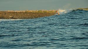 |
| Myself, headed for the inside speedrun |
Cut back, work the board back and forth near the soup, and then sweep way down to the bottom, lean hard on my heels and put some rail into the water, and fly through a really nice section, and then come out on the other side of that and then continue to work it down point, and finally kick out on the inside, but not all the way down into the Stupid Zone where I had run afoul of things earlier.
Well then, maybe this wave is ok, hmm?
FUCK YEAH!!
Thus began one of the funnest surf sessions I’ve had in a long time.
And keep in mind that it wasn’t very long ago at all that I was surfing overhead Boca Barranca.
This wave on the south side of Santa Cruz is the shit, boys and girls.
The four of us began surfing ourselves silly, all thoughts of checking alternative breaks banished from my mind.
The speed and power of the wave, along with the flawless layout of the break, served to just completely render the crinkle on the surface of the water a total non-issue.
I can live with this, yes I can.
The water was clear as a bell, and you could see the rocky bottom flying along beneath you as you rode.
On one particularly large set, I just went for it kamikaze style, as much to see what the impending wipeout would be like as anything else.
Stood up at the top, late, with an unmakeable wall out in front of me, and just launched my damnfool self into it anyway.
Straight down to the bottom into a dive-bomb pearl, and I get my wipeout.
The water is nice and deep, and I come nowhere near to hitting the bottom.
Popped back up to the surface, hopped back on the board, and paddled back outside grinning like a fool.
No problem.
The wave here reminds me of Hawaii, with the way the water heaves and moves.
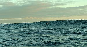 |
| Jimbo having fun in the Galapagos Part 1 |
Each wave has a sizeable volume for its height, and you can feel the power of this much water surging along within each wave.
On the smaller ones, that everybody besides myself seems to be more interested in riding, the wave comes in, starts winding down the point, and that’s pretty much that.
With the bigger ones, the oncoming wall takes on a very slightly peaked up aspect, away from the point, and then comes over and sort of stops for a little bit, while things gather themselves up for the subsequent race down the coastline.
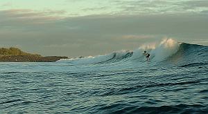 |
| Jimbo having fun in the Galapagos Part 2 |
What you get is this really nice drop, with an excellent bottom turn, followed by a race with a very healthy whitewater. Once you’re around this initial part of the break, you’ve got to remember ease back on the throttle a little bit, or you’ll find yourself out on a fat sloping shoulder too far and you’ll forfeit the ride right then and there.
So instead you pull the nose of the board back to straight in, or even give it some fade, and let the wave sort itself out.
Which it does.
So you’re working the board back and forth, right next to the soup, watching as you head in toward the middle section.
The wave then sucks itself back up and if you time it right you get to carve hard off the bottom as the wall goes vertical, and you find yourself just FLYING through this part of the wave, screaming down the wall.
After you’ve made that section, the wave once again kind of eases off, just a little this time, and resets for one more go as you approach the far inside.
Work it with some nice real estate gobbling sweeps, maybe shoot it fast down the last part of the track, and then kick out.
And then you’re staring a two to two hundred and fifty yard paddle back out to the head of the point.
This is just an amazingly workable wave.
The wind and crinkle somehow just doesn’t even seem to enter into the deal at all.
Of course, the wind isn’t all that strong anyhow. We’re sitting right on top of the equator here, and synoptic scale effects tend to just disappear in this area. Which results in a breeze that never seems to really want to go to work and blow. Like I said earlier, there’s no whitecaps. And there also doesn’t seem to be any wobble or disorganization, either. Just this crinkly texture that doesn’t interfere with the wave as it winds on down the point.
Strange how that works.
We took a bunch of pictures, but I’ve decided that it’s impossible to capture the true character of this wave with a camera.
The pictures come out looking like the wave is kind of mushy, or even very mushy.
What the picture can’t show is your down the line speed as you’re riding.
Hell, I can’t explain it.
This place is just DIFFERENT.
You’ll have to ride it for yourself if you want to properly understand what’s going on.
Andres and Christian will take you here, if you like.
So ok, it certainly appears as if you CAN surf the Galapagos in the summer months.
Christian, Andres, and Andresito ALL averred that what we caught was just about as bad as it can get, and this makes sense to me.
We checked the swell on the computer as I mentioned earlier, and it was running at a background size of four and a half to five feet.
Check for yourself, and you’ll see that it hardly ever gets any smaller than that during this part of the year. And of course that four and a half to five feet is the size of the open-ocean swell, as would be recorded by a buoy, and that the water in that size of a swell will pile up quite a bit higher as it encounters the shoreline and breaks.
And the wind along the equator is always light, no matter where it’s blowing from.
So………..I can easily see this place really getting GOOD.
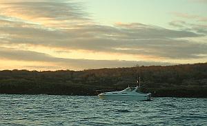 |
| Day's end at Chicken Hill |
We surfed and surfed and surfed, and finally the sun dropped below the horizon.
We finally departed, wishing that we’d gotten here sooner.
Ah well.
Into the Maverick, slapping high fives all around, shouting and laughing.
Towel off, fire up the diesels, and away we go.
It’s a long ride back, and dark overtakes us along the way.
Somewhere along in the middle of things, as the sky darkened, the clouds broke and I could see Alpha Centaurus and the Southern Cross glimmering through the thickening gloom.
What a nice finishing touch to a glorious day.
Once it got good and dark, the phosphorescence in our wake took the place of starlight overhead when the cloud cover returned.
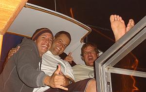 |
| Andresito, Jason & Andres ... Stoked! |
Everyone was just as happy as they could be.
We returned to Puerto Ayora in the dead of night.
And still no seasick for Jimbo. Tra la la.
Dinner at a small restaurant, where we finally are reunited with Washington, who flew in on the “early” plane, two hours after we arrived.
We sit around the table and talk story and plan for tomorrow.
And the consensus is that we may as well ditch our entire game plan and instead stay right here on Santa Cruz and ride this wave again tomorrow.
I can’t wait.
Previous PageNext Page |
16streets.comΩ |